Lido
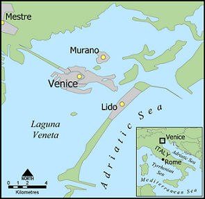
The Venice Lido is a narrow long island of 11km long. It’s the natural barrier between the Venetian Lagoon and the Adriatic Sea. The historic centre of Venice is located between the Lido and the mainland.
About 20.000 people live on the island. Other than the historic centre, cars are allowed here. The water bus Line 1 connects Piazzale Roma via the Grand Canal with the Lido. The journey takes 19 minutes from the stop at St. Mark Square to the island. To Marco Polo Airport is one hour.
Hotels Lido
Most tourists on the island come for the beaches. The 5-star Hotel Excelsior is one of the most luxury properties on the island. Grand Hotel Des Bains is still famous but was closed in 2010. It’s yet a luxury apartment building. Grande Albergo Ausonia & Hungaria Wellness & SPA is a 4-star hotel and rated for the best value. With the water bus it’s 15 minutes to St. Mark’s Square. Hotel & Residence Venezia 2000 (737 reviews, 8.2) is a 3-star beachfront hotel with views over the Adriatic Sea.
Venice Lagoon
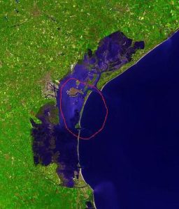
The Venice Lagoon is a large enclosed bay between the mainland of Italy and the Adriatic Sea. It has a size of about 550 km2. Three narrow inlets are the natural barrier of the Venetian lagoon: the Lido, Malamocco and Chioggia. The largest part of the Lagoon (80%) consist of mudflats, salt marches and tidal shallows. About 8% of the Lagoon is land including the historic centre of Venice (5km2).
During autumn and wintermonths there can be a spring tide in Venice. When the spring tide is much higher than the normal sea level (+90/+110cm), sirens will warn the public. San Mark Square is the lowest part of Venice and will then be flooded by the water. Link: tide forecasts for the lagoon
